Your Guide to Islamorada Canal Neighborhoods for Boaters
March 5, 2026
March 5, 2026
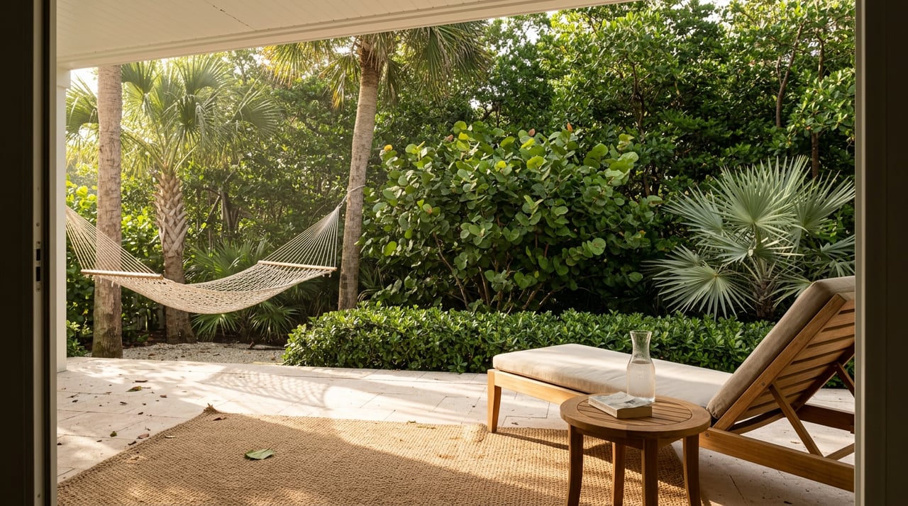
What kind of boater are you in Islamorada? Maybe you want quick ocean runs to the reef, quiet sunset cruises in the bay, or stealthy flats missions at first light. Picking the right canal neighborhood is the difference between easy, everyday boating and constant workarounds. In this guide, you’ll see how the most popular Islamorada canal areas line up with your style, what to verify before you buy, and how local rules shape daily use. Let’s dive in.
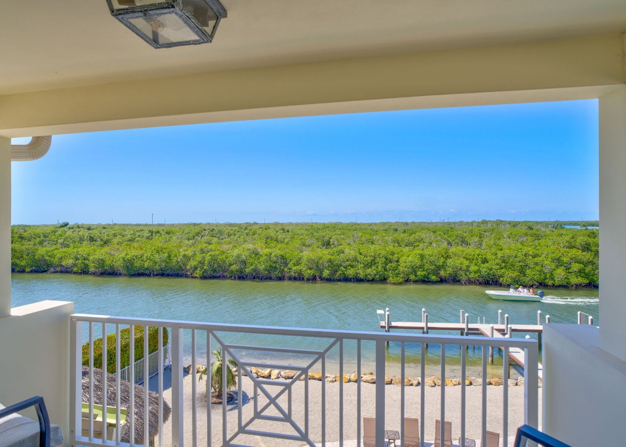
Islamorada spans four main islands with about 64 canals and roughly 24 miles of canal shoreline. Many canals were built decades ago and have different depths and circulation. The Village runs ongoing canal restoration because water quality and usability matter for long-term value. You can review the Village’s program and project list on the Canal Restoration page at the Village site. Explore the Canal Restoration program.
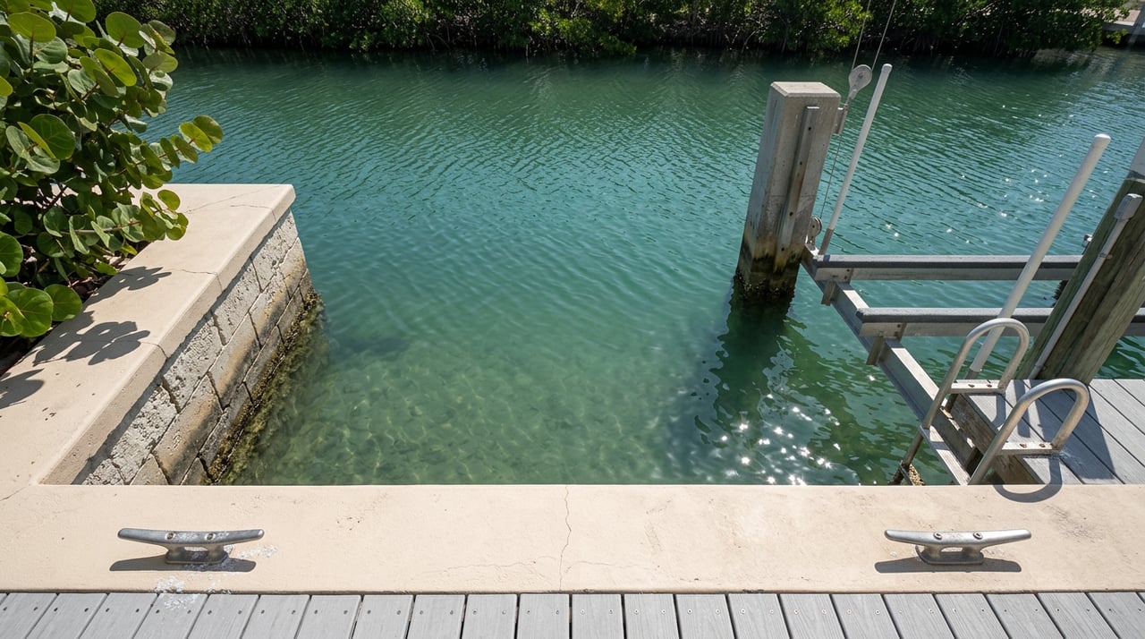
Local marinas and ramps backstop everyday boating. Founders Park’s Plantation Yacht Harbor Marina is a central hub with fuel, pump-outs, slips, and a public ramp. The marina reports a controlled depth of about 5 feet, which is a useful reference point when you size boats for local waters. See services and depth at Plantation Yacht Harbor.
Waterfront rules shape dock design and access. Village code favors T or L style docks, sets minimum depths at the dock terminal (often 4 feet at mean low water), and limits how much a dock can project into a waterbody. Dredging in seagrass or hard-bottom areas is restricted. Understanding these rules helps you plan lifts, davits, and dock upgrades. Review Village shoreline and dock regulations.
Islamorada also sits within the Florida Keys National Marine Sanctuary. NOAA’s Restoration Blueprint advances protections like mooring buoy management and limits on anchoring in sensitive zones. That affects where you can anchor and what seabed work is allowed. Read the Restoration Blueprint overview.
Below are the canal neighborhoods that tend to fit three everyday profiles. Use them as a starting point, then verify depths, bridge clearances, and HOA rights at a specific property.
Anglers Reef (Windley Key, ~MM 85–86). If you want a resort-style setup with direct ocean access and minimal dock maintenance, Anglers Reef is built around a protected community marina and small basin. Owners rely on community slips rather than long private docks. Listings commonly show slips sized for boats around 30 to 35 feet, so confirm your LOA and rules before you buy. For a sense of typical slip use, see a representative community rental description with slip details. Check a representative Anglers Reef slip setup.
Venetian Shores, open-canal side (Plantation Key, ~MM 86). Venetian Shores is well known for wide, deep canals and fast access to Snake Creek, which leads straight to Hawk Channel and the Atlantic. Many homes feature long seawalls, cut-in slips, and heavier lifts that suit offshore center consoles and sportfishers. The neighborhood has both open canals and plugged canals, so confirm your specific street and canal. See Venetian Shores canal and HOA info.
Bridge tip: Snake Creek’s bascule bridge has about 27 feet of vertical clearance when closed and opens on signal under federal drawbridge rules. Your tower, outriggers, and timing all matter. Review Snake Creek bridge regulations.
Port Antigua / White Marlin Beach (Lower Matecumbe, ~MM 74–75). A bayside community with a private sandy beach, a neighborhood ramp, and broad canals that feed into Florida Bay. You get protected water and short runs toward the Channel 2 and Channel 5 area for transits to open water. Many owners keep shallow-draft skiffs, smaller center consoles, and family cruisers. See Port Antigua POA amenities and rules.
Plantation Key near Founders Park (MM 87 area). Here, you get protected bayside canals and immediate access to a full-service public marina. Plantation Yacht Harbor provides fuel, pump-outs, slips, and a ramp, which is handy as your daily backup plan or for guests. It reports a controlled depth of about 5 feet, but always confirm current soundings. View Plantation Yacht Harbor details.
Before you finalize a waterfront plan, line up the local rules that matter most to daily use:
Dock design and depth. Village code generally requires perpendicular T or L style docks and sets minimum terminal depths, often 4 feet at mean low water, with additional protections over seagrass. Review the Village code summary.
Sanctuary overlays. The Florida Keys National Marine Sanctuary’s Restoration Blueprint works to expand mooring buoy use and protect sensitive habitat. Plan anchoring and any seabed work with this in mind. Read NOAA’s overview.
Canal restoration status. Some canals have added culverts, air curtains, or injection wells to improve water quality and flow. This can influence long-term desirability. Check the Canal Restoration list.
Use this checklist when you evaluate a specific canal home. It will save time and surprises.
Controlling depth. Ask for the shallowest point from the dock to open water at mean lower low water, and whether recent soundings exist. The Village code cites minimum dock depths, and marinas publish controlled depths you can use as references. See Plantation Yacht Harbor’s depth and review code context.
Canal type. Is it open to marked channels or plugged with no backyard route? On plugged canals, verify any deeded slip or POA ramp access in writing. Confirm HOA patterns at Venetian Shores.
Bridge and air draft. If you must pass under Snake Creek or another span, measure total air draft with antennas and towers. Check the current drawbridge notice before you plan runs. See the bridge regulation.
Dock permits and design. Verify that the existing dock, lifts, and davits were permitted and inspected by the Village. Ask what the code would allow for any change. You can search the Village’s permit portal for past records. Use the CityView permit locator.
HOA, deeded rights, and slips. If a property relies on a community slip, confirm transfer rules, fees, and any length or beam limits. Review HOA resources and patterns.
Turning room. For larger boats, measure the turning basin and check for obstructions or narrow geometry. If you cannot find a published turning radius, plan a supervised on-water check at slack tide.
Marina support. Note the distance to fuel, pump-outs, and a public ramp. Founders Park is a reliable anchor point for daily needs and contingencies. See marina services. A broader overview of area marinas is also helpful when planning a backup slip. Scan a local visitor guide with marina listings.
Environmental overlays. Are there sanctuary preservation areas or no-anchoring zones nearby? Confirm locations so your day routes stay compliant. Review sanctuary changes.
Storm and insurance planning. Ask about seawall condition, flood zone notes in the listing, and the marina’s hurricane readiness if you plan to move the boat. Local marinas publish emergency plans, which can guide yours. Start with Plantation Yacht Harbor.
Low-tide field test. If possible, run the approach at low water and talk with a local dockmaster or captain about recent soundings, especially after storms. Long-time operators are excellent sources. Connect with a historic local marina.
Depth numbers on paper are a starting point. Your real-world path to open water may include a controlling shoal, a tight turn, or weekend traffic. Do a daylight shakedown run at or near low tide, log your sounder readings, and watch for crosswinds in narrow turns. If a community slip is part of the plan, confirm the dock power, water, and rules on-site.
If you see yourself pushing through Snake Creek at sunrise, sliding into the bay for sunset, or poling the flats at dawn, the right canal makes it easy. With fourth-generation Keys roots and hands-on design and construction expertise, you get help that spans selection, permitting guidance, dock planning, and post-close improvements. When you are ready to compare options or calibrate a specific listing to your boat, connect with Kelsey Caputo-Frins for a tailored plan.
Stay up to date on the latest real estate trends.
Lifestyle
4th of July in the Florida Keys
Real Estate
Waterfront living in Marathon Florida
Real Estate
Why Buyers Are Choosing Plantation Key for Luxury Waterfront Living